
Current River Watershed
Google Earth Links
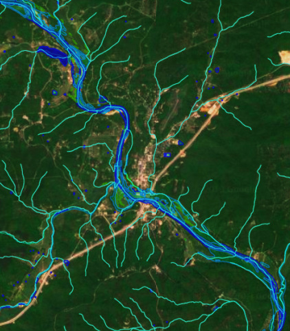
Hydrology / Hydrography
Flows
MDNR - Missouri Classified Streams
USGS National Hydrography Dataset 1:24,000 Flows
MoRAP Missouri Valley Segment Type 1:100,000 Flows
Wetlands & Water Bodies
National Wetlands Inventory (1987)
USGS National Hydrogrpahy Dataset 1:24,000 Waterbodies
Karst
MDNR - Missouri Inventory of Springs
MDNR - Missouri Inventory of Sinkholes
MDNR - Missouri Inventory of Losing/gaining streams
Watersheds
USGS NHDH - Current River HUC 8 Watershed Boundary
MDNR - Missouri HUC 14 Sub-Watersheds
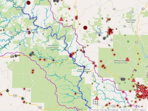
Environmental Impacts
Pollution Sites
EPA - Brownfields
EPA - Superfund Sites
MDNR - Missouri Emergency Environmental Response Reports
MDNR - Hazardous Waste Generators
MDNR - All known landfills
NPDES (National Pollution Discharge Elimination System)
MDNR - NPDES Permitted Effluent Outfalls
MDNR - NPDES Permitted Stormwater Outfalls
Mining & Prospects
MDNR - Missouri Inventory of mines and prospects
MDNR - Industrial Mineral Mineral Mines
MDNR - Metallic Mineral Waste Management Areas
MDNR - Missouri Inventory of mines and prospects
MDNR - Industrial Mineral Mineral Mines
MDNR - Metallic Mineral Waste Management Areas
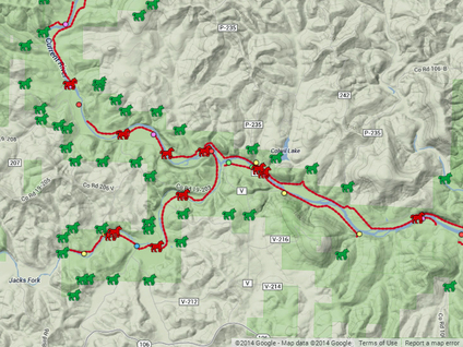
Recreational Use
Horses
ONSR Horse trails parallel to rivers
ONSR Horse Trail River & Park Boundary Crossings
Access Points
Current River vehicular River Access Points
Jack's Fork Vehicular River Access Points
Horses
ONSR Horse trails parallel to rivers
ONSR Horse Trail River & Park Boundary Crossings
Access Points
Current River vehicular River Access Points
Jack's Fork Vehicular River Access Points
Once you have downloaded the files they can be opened in Google Earth.
download google earth at earth.google.com
download google earth at earth.google.com