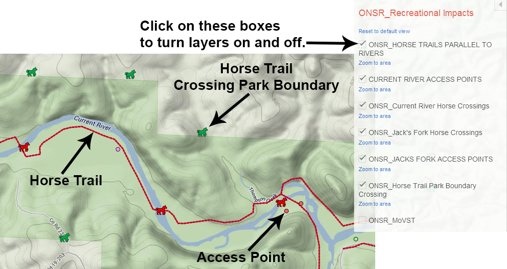
Recreational useTakes many forms, and this only depicts information regarding use in terms of horse trails along the river, access points, and the locations where horse trails cross the ONSR park boundary. This data was collected and compiled by Jerry Sugarman.
|
|

|